


I hiked the Kew Mae Pan Nature Trail on Doi Inthanon on 9 January 2026, right in the middle of the official cool-season opening period. I wanted to see for myself whether the famous “sea of mist” and ridgeline views justified the early start from Chiang Mai, and how this much-talked-about trail actually feels underfoot. What follows is a detailed account of that day, from the pre-dawn drive and entrance fees to the mossy forest, exposed ridges and the reality of hiking above the clouds in northern Thailand.
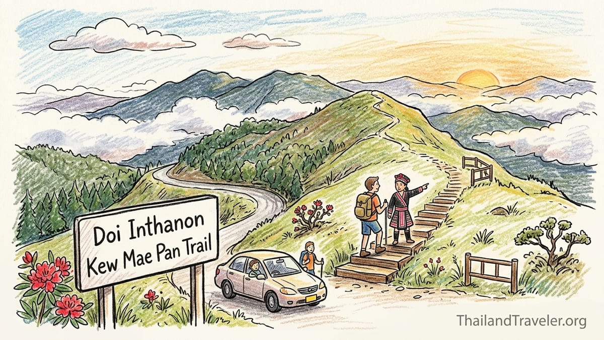
Planning the Hike and Reaching the Trailhead
I based myself in Chiang Mai’s Old City and arranged the hike for Friday 9 January 2026, during Kew Mae Pan’s seasonal opening window, which typically runs from around November to the end of May depending on weather and conservation closures. I chose January because local guides described it as a sweet spot: cool, generally dry mornings with a good chance of cloud inversions, but before the late-season haze that can mute long-distance views.
I decided not to join a packaged tour from Chiang Mai and instead hired a licensed driver with a sedan for the day through my guesthouse. The quoted price was 2,700 baht for a private round-trip, including fuel and waiting time inside Doi Inthanon National Park but not including park or trail fees. We left Chiang Mai at 5:30 in the morning, when the city streets were still quiet and the air temperature in town hovered around 18 degrees Celsius.
The drive south along Highway 108 and then west along the wide 1192 and 1009 took about 1 hour 40 minutes with a brief petrol station stop for coffee. Sunrise tinted the rice fields and low hills pink, while mist pooled in the valleys. By the time we passed the national park checkpoint near the town of Chom Thong, the sky was clear with only thin streaks of high cloud. It looked like a promising day for ridge-top views rather than a thick blanket of fog.
At the park entrance I paid the official foreign visitor fee for Doi Inthanon National Park: 300 baht for myself plus 30 baht for the vehicle. Thai nationals paid 60 baht per person and 30 for a vehicle on the same day, but foreign pricing is firmly set higher and is non-negotiable. With the receipt stashed in my daypack, we continued the sinuous climb toward the summit area, passing Wachirathan Waterfall in half-light and several viewpoints already dotted with early risers and coffee stands.
Checking In, Fees and Meeting the Local Guide
The Kew Mae Pan trailhead sits near kilometer marker 42 on the road that climbs toward the royal pagodas and the summit. We pulled into the small parking area just after 7:20. The air temperature, according to a large digital display near the nearby coffee stall, read 9 degrees Celsius. I stepped out of the car and felt an immediate chill. The difference from Chiang Mai’s mild dawn was dramatic, especially with a light breeze flowing over the ridge.
Kew Mae Pan requires visitors to register and walk with a local Hmong guide. At the simple office by the parking lot, a laminated sign in Thai and English confirmed the compulsory guide system and indicated the official opening hours that day, starting at 6:00 and closing to new entries mid-afternoon. The guide fee was fixed at 200 baht per group for the entire 3-kilometer loop. I paid the fee in cash, signed the registration sheet with my name and nationality, and received a handwritten number corresponding to my assigned guide.
My guide introduced himself in halting English as Preecha, a Hmong villager from the nearby community that co-manages the trail. His English was basic but functional. He had a laminated chart with photos of local birds and rhododendron species, and he reassured me, with a grin, that the trail was “not too hard, but many steps” and that we would “stop many time for picture.” I tucked a 100 baht note into a separate pocket for a potential tip, expecting that his role would be more than simply walking in front.
Including the national park entrance, vehicle fee, Kew Mae Pan guide fee and my private driver from Chiang Mai, my total outlay for the day was 3,230 baht before food or coffee. For budget-conscious travelers, this breakdown matters. A group tour from Chiang Mai, which typically includes transport, guide, lunch and several other stops such as waterfalls and the royal pagodas, often comes in around 1,800 to 2,200 baht per person, but those tours also move on a tight schedule and do not always allow you to linger at Kew Mae Pan if the light is magical.
Into the Cool, Damp Forest: Moss, Ferns and Slippery Steps
We began walking from the official trailhead sign at 7:35. The first impression was not of wide vistas but of enveloping forest. The earth path, about a meter wide, led gently uphill between tall trunks clothed in moss and epiphytes. Ferns of different shapes crowded the slopes. The air was markedly cool and damp, with that rich, sweet smell of leaf litter and humus you associate with cloud forests rather than tropical beaches. My breathing stayed easy, but the altitude near 2,200 meters made the air feel thinner compared to Chiang Mai.
The first several hundred meters are shaded and can be surprisingly slippery. The previous week had seen patchy rain storms on Doi Inthanon, and the soil had not completely dried. Timber steps, hammered into steeper sections, were darkened with moisture and coated in places with a fine film of mud and moss. I was glad to be wearing trail running shoes with decent grip rather than sandals. Even then I placed each foot carefully. I saw two Thai visitors in white sneakers clutching roots and trunks on the first descent after the initial rise, laughing nervously as their shoes squeaked on the damp earth.
Already in this forested section, Preecha began pointing out details I might have missed. He tapped a fallen branch cushioned with luminous green moss and explained, “This always wet, even dry season.” He showed me the fine hairs on certain leaves that help trap moisture from the frequent mists, and a tiny orchid clinging to a branch at my eye level. When we heard a sharp, metallic bird call high overhead, he paused and scanned the canopy, then indicated a small movement. “Green-tailed sunbird. Here cold, different color,” he said, referencing the local subspecies that birdwatchers come to see.
The physical effort in this first third of the loop felt moderate. There were short, sharp ascents with sets of rough wooden steps that raised my heart rate and warmed my hands despite the nine-degree air. The ground was uneven, with roots acting as both stairs and stumbling hazards. I took two brief breathers of less than a minute each, partly to photograph sunbeams filtering through the canopy and partly to let my legs adjust to the rhythm of the steps. I had started with a light fleece over a synthetic long-sleeved shirt, quick-dry hiking pants, a thin beanie in my pocket and lightweight gloves. Within twenty minutes I had unzipped the fleece and pushed up my sleeves.
Breaking Out Onto the Ridge: Above the Valleys and Into the Wind
After about 30 minutes of steady walking with photo stops, the forest gradually thinned. The path climbed to the right, and more light filtered through the leaves. The transition was subtle at first, then sudden. The trail turned left, the last tall trees fell away, and we stepped out onto the famous grass-covered ridge of Kew Mae Pan. It felt like walking from a dim green room into an open balcony suspended above northern Thailand.
The contrast in temperature and exposure was immediate. A cool wind slid up the slope from the valley and hit my face with surprising force. I pulled my fleece back up and was suddenly grateful for having packed a beanie. The ridgeline here is relatively narrow, with steep, grassy slopes dropping away on both sides and patches of stunted shrubs and occasional small trees breaking the monotony of the grasses. The observation platforms are simple wooden decks with waist-high railings, set a step or two above the trail to minimize erosion.
On this particular January morning the “sea of mist” partially lived up to its name. Directly below the ridge, clouds clung to the forested valleys in torn, shifting patches rather than as an unbroken white carpet. In the distance, layers of blue and grey mountains marched toward the horizon. To the east, the rising sun lit the edges of the clouds in gold. To the west, a curtain of thinner cloud drifted across more distant peaks, occasionally obscuring them entirely for a minute or two before tearing open again. It was not the textbook brochure image of a solid white ocean, but the dynamism of clouds in motion felt more alive.
We paused at the main viewing platform for nearly twenty minutes. A handful of other hikers shared the space: a couple from Bangkok with a tripod, two backpackers from Europe clutching enamel mugs of coffee from the parking lot stall, and a Thai family with school-aged children. We took turns at the railings, and there was no sense of crowding yet. From this vantage, Preecha traced invisible lines across the valley, pointing out the route of the road below, nearby villages and, farther away, a faint ridge where he said his parents used to farm corn on steep slopes before conservation rules tightened. His commentary added a layer of human history that does not appear in simple trail descriptions.
Assessing Difficulty: Time, Effort and Trail Reality
Official descriptions often label Kew Mae Pan as an “easy to moderate” nature trail suitable for most visitors with basic fitness. After walking it, I would personally frame it as moderate with some challenging sections, especially for those unused to uneven terrain, steps and altitude. The full loop is about 3 kilometers. With plenty of stops for photos and interpretation, my total time on the trail was 2 hours and 5 minutes from trailhead back to the parking lot, including the long pause at the main viewpoint.
In terms of physical effort, the ridge section felt easier on my lungs but harder on my knees. There are several steep artificial staircases made of wood and packed earth, some descending and then re-ascending along the contour of the mountain. In dry conditions they would be straightforward, but patches of lingering dampness and occasional slick mud turned several stretches into cautiously negotiated descents. I witnessed two minor slips, both from visitors wearing flat-soled casual shoes. Neither resulted in injury, but both left muddy backsides and nervous laughter.
The return leg, which re-enters the forest, includes a series of long staircases that climb steadily back toward the starting elevation. Here I felt the altitude more distinctly. My breathing quickened, and my thighs began to burn slightly. I counted roughly 180 steps on one continuous section, though this is an approximation rather than an official figure. We stopped twice for short rests of two or three minutes each, with Preecha using the breaks to point out red-flowering rhododendrons that bloom in the cool season and to describe how their presence indicates the particular microclimate of these high-elevation ridges.
By the time we emerged back at the trailhead clearing at 9:40, the parking area had filled markedly. Minivans with Bangkok license plates and tour company logos lined the entry, and a larger number of people milled around the registration hut. I was glad we had started early. In my experience, the trail was slightly more demanding than the “easy walk” label sometimes used by tour promotions, especially when you factor in slippery ground, frequent steps and the thin highland air. For reasonably active travelers, it is very manageable, but those with knee issues or minimal hiking experience should treat it as a real hike rather than a simple stroll.
The Guide’s Role, Language and Environmental Rules
Walking with a local guide changes the experience of Kew Mae Pan in several important ways. First, it enforces a slow, observant pace. Preecha gently discouraged rushing, especially in the forest sections where shortcuts around muddy patches could damage fragile groundcover. He repeatedly reminded visitors not to step off the narrow packed-earth path onto the mossy banks. At one point he quietly asked a young man who had walked slightly beyond an informal rope barrier at a viewpoint to step back, explaining that the grass roots help lock the soil in place on the steep slope.
Second, the guide system supports local communities that have seen their livelihood shift from slope agriculture to tourism. On the ridge, Preecha spoke about seasonal changes: birds that arrive in the cool season, the way cloud formations differ between January and April, and how certain plants close their leaves during the driest months. His English did not extend to complex ecological explanations, but he could name several species and communicate basic concepts such as why visitors are asked not to pick flowers or break branches for photos.
In terms of language, the registration hut displayed basic information in Thai and English, including a simple map of the loop and safety instructions. Along the trail itself, signboards were more limited. A few small wooden plaques gave the names of certain plants in Thai and Latin, and one larger sign near a viewpoint described the concept of a cloud forest, again in both languages but with simple phrasing. If you are seeking in-depth natural history interpretation in fluent English, the mandatory local guide alone may not fully satisfy you. Pairing Kew Mae Pan with a knowledgeable Chiang Mai-based naturalist guide or joining a small-group eco-focused tour is a good option for travelers who want detailed explanations.
Environmental restrictions are visible and, in my view, necessary. Wooden railings and rope lines steer feet away from the most fragile grass slopes and shrub patches. There are signs prohibiting drones and requests to carry out all rubbish. I did not see any overflowing bins or litter on the day I visited, which suggests that, at least at this time, the combined effect of rules and guide oversight is working reasonably well to protect this sensitive highland environment from the thousands of seasonal visitors it receives.
What I Wore, Carried and How It Felt on the Day
Clothing and gear can make the difference between a comfortable highland walk and two hours of shivering and frustration. On my January visit, the pre-8:00 air temperature hovered around 9 to 10 degrees Celsius at the trailhead, rising to perhaps 13 or 14 degrees by the time we finished, with a noticeable wind on the ridge. I wore a moisture-wicking long-sleeved base layer, a lightweight fleece jacket, quick-dry hiking pants, mid-weight trail running shoes with grippy soles and ankle socks. I carried a compact beanie, light gloves and a buff-style neck gaiter in my pack.
In practice, this combination worked well. I began the forest section feeling slightly cool in the shade but warmed quickly once we hit the first sets of steps. I carried the beanie in my hand until we reached the exposed ridge, where the wind prompted me to pull it on. The fleece stayed on for most of the hike, though I opened it fully during steeper climbs. I passed several visitors in cotton hoodies and fashion sneakers who looked uncomfortable trying to negotiate slick slopes and complained of cold fingers while fiddling with phones and cameras at the viewpoints.
For carrying water and camera equipment, I used a 20-liter daypack with a simple hip belt. Inside I had a 1-liter reusable bottle, a compact mirrorless camera with a 24–70 mm equivalent lens, a lightweight rain shell in case of passing showers, sunscreen, a small snack and my wallet in a zip pocket. One liter of water was sufficient for the 2-hour loop in cool conditions, especially after already hydrating in the car. On hotter or sunnier days later in the season, I would consider carrying 1.5 liters. The trail does not have any water refill points once you leave the parking area.
Photographing while walking required caution. The combination of narrow path, occasional sheer slopes and other hikers behind meant there were only certain spots where stopping to compose a shot felt safe and considerate. I often stepped slightly to the side in wider sections or waited for platforms with railings. A neck strap and willingness to keep the camera in the bag during the more slippery descents kept my hands free to brace or catch myself if needed. For phone photographers, a simple wrist strap offers similar peace of mind.
Comparing Kew Mae Pan With Ang Ka Nature Trail
After a short break at the parking lot coffee stall and a quick snack from a nearby vendor, we drove the remaining kilometers toward the summit of Doi Inthanon and stopped at the Ang Ka Nature Trail parking area near the “Highest Point in Thailand” sign. I wanted to compare the more demanding Kew Mae Pan loop with this shorter, boardwalk-based walk that many visitors mention as an easier alternative. We started Ang Ka just after 10:30, when the air temperature at the summit was recorded at 7 degrees Celsius, though the lack of wind in the forest made it feel less biting.
Ang Ka is a compact loop of around 300 to 360 meters, almost entirely on an elevated wooden boardwalk through a dense, moss-coated cloud forest. The contrast with Kew Mae Pan’s open ridges is striking. Here, you remain under a closed canopy the whole time. The wooden railings and planks are dark, damp and in places slick with moisture and moss. Informational signs in Thai and English explain aspects of the high-elevation peat swamp and highlight particular plant species. There is no requirement for a local guide, and many people walk it independently in 20 to 30 minutes, pausing to photograph the dripping branches and curtain-like ferns.
Physically, Ang Ka is much easier. There are shallow steps but nothing as sustained or steep as Kew Mae Pan’s staircases, and the total time commitment is short. For visitors who want to experience the atmosphere of a high Thai cloud forest without the exertion of a longer hike, Ang Ka is close to ideal. The main challenge is footing; the boardwalk can be slippery, especially after rain, so slow, careful walking and decent shoes still matter. On my visit, mist hung in the trees and droplets clung to every surface, creating a soft, muted light that made the forest feel almost prehistoric.
From a photography and crowding perspective, the two trails serve different tastes. Kew Mae Pan offers expansive mountain and valley vistas, especially in early morning side-light, with compositions that combine rolling ridges, shifting clouds and the sinuous line of the trail itself. Crowds build steadily from mid-morning, and some platforms can feel busy. Ang Ka is about intimate detail: macro shots of moss, water droplets on leaves, close-ups of gnarled trunks. Despite being next to a popular summit parking area, visitors disperse along the boardwalk, and I never felt pressed by crowds. Those who enjoy quiet, contemplative nature walks may actually prefer Ang Ka, while those seeking drama and big landscapes will gravitate toward Kew Mae Pan.
Tours From Chiang Mai vs Going Independently
Having walked Kew Mae Pan and Ang Ka with a local Hmong guide and a private driver, I spent the drive back to Chiang Mai thinking about the pros and cons of this approach compared with booking a full tour package from the city. Organized day tours commonly bundle transport, national park fees, an English-speaking guide, lunch and multiple stops, such as one or two waterfalls, the royal pagodas and a hill tribe market, often for a per-person price comparable to what I spent as a solo traveler on a private car plus my own park payments.
The main advantages of a Chiang Mai tour are simplicity and interpretation. You are picked up and dropped off at your hotel, your guide usually handles park entry formalities, and you have someone on hand who can explain more complex cultural or ecological topics in fluent English. In some cases, the tour guide will accompany you, alongside the mandatory Hmong guide, on Kew Mae Pan itself, adding another layer of explanation. For couples or small groups who prefer not to think about logistics, this can be appealing.
Going independently with a driver, on the other hand, gave me flexibility. I could choose exactly when to start Kew Mae Pan, how long to linger at viewpoints, whether to add Ang Ka or extra waterfalls, and when to stop for coffee or photos along the road. My local Hmong guide on the trail had lived experience of the mountain, while my Chiang Mai-based driver shared anecdotes about seasonal road closures and traffic waves. The trade-off was cost as a solo traveler and the need to research up-to-date fees and opening information ahead of time.
For budget travelers willing to accept less flexibility, joining a small-group tour that explicitly guarantees a full Kew Mae Pan loop and mentions the local guide requirement in its description strikes a good balance. Be aware that not every Doi Inthanon tour includes Kew Mae Pan, and some only offer a short viewpoint stop near the trailhead without walking the full loop. Reading the fine print or confirming by message helps avoid disappointment if your heart is set on those ridge-top views.
The Takeaway
What surprised me most about hiking Kew Mae Pan was how unequivocally “mountainous” it felt, despite being in a country that many visitors still associate primarily with beaches and islands. The combination of thin, cool air, the smell of wet earth and moss, and the sight of clouds rising and dissolving below the ridge evoked highland walks far from the tropics. Yet the bird calls, the specific shrubs and the presence of Hmong guides rooting the experience in local communities reminded me that this was unmistakably northern Thailand.
Did the trail justify the early start from Chiang Mai? For me, absolutely. Standing on the ridge as the first sunbeams broke through the clouds and lit distant slopes felt like one of those rare travel moments when effort, timing and conditions align. The cool, damp forest approaching and leaving the ridge gave the hike a narrative arc, as if I had walked from one distinct world to another and then back again. Even the physical challenge added to the sense of accomplishment without ever tipping into Type 2 suffering.
If I were to change anything next time, I would aim to arrive at the trailhead even a little earlier, closer to 7:00, to enjoy the initial forest section in deeper hush and to have more time at the viewpoints before the first wave of tour groups. I might also carry a slightly longer camera lens for compressed mountain layers, and perhaps pack a thin down vest for those particularly chilly mornings in December and January. In March or April, I would place more emphasis on extra water and sun protection.
Not everyone, however, needs to tackle Kew Mae Pan. Travelers with limited mobility, heart or knee issues, very young children, or a strong dislike of heights and steps may find it more stressful than rewarding. For them, Ang Ka Nature Trail, the royal pagodas with their elevators and gentle ramps, or simple viewpoints accessible by car offer more relaxed ways to taste the highland atmosphere of Doi Inthanon. For hikers who are reasonably fit, steady on uneven ground and curious about seeing Thailand from above the clouds, Kew Mae Pan is a memorable and worthwhile addition to a Chiang Mai itinerary.
FAQ
Q1. When is Kew Mae Pan Nature Trail open to visitors?
Officially, Kew Mae Pan is open during the cool and early hot seasons, typically from around November to the end of May, though exact dates can vary by year depending on weather and conservation needs. It is closed in the wetter months for ecological recovery, so checking current announcements from Doi Inthanon National Park or local operators before your trip is important.
Q2. How much did it cost to hike Kew Mae Pan in January 2026?
On my 9 January 2026 visit, I paid 300 baht as a foreign adult for Doi Inthanon National Park entry, 30 baht for the car, and 200 baht for the mandatory local guide at Kew Mae Pan. I also paid 2,700 baht for a private round-trip driver from Chiang Mai, making my total out-of-pocket cost 3,230 baht before food, drinks and tips.
Q3. Do I really need a guide for Kew Mae Pan, and what do they do?
Yes, a local Hmong guide is mandatory for walking the Kew Mae Pan loop. The guide leads the group, helps set a safe pace, explains basic natural and cultural features, and encourages visitors to stay on the trail to protect vegetation. While English levels vary, their presence also supports local communities that have shifted from farming to tourism-based livelihoods.
Q4. How difficult is the trail and how long does it take?
I would rate Kew Mae Pan as moderate. The loop is about 3 kilometers with many steps, some steep sections and often slippery ground in the forest portions. At around 2,200 meters altitude, the air feels thinner than in Chiang Mai. With frequent photo stops and short rests, my hike took just over two hours from start to finish. People who are moderately fit and steady on their feet usually manage well, but it is more demanding than a flat city park walk.
Q5. What should I wear and bring for a winter season hike there?
In the cool season, I recommend long pants, a moisture-wicking long-sleeved top, a warm layer like a lightweight fleece, and closed shoes with good grip. Pack a hat or beanie, light gloves if you get cold easily, at least one liter of water, sunscreen, and a small rain shell. A daypack to carry layers and a camera or phone, plus some cash for the guide fee and snacks, is also useful.
Q6. Did you actually see the “sea of mist” from the ridge?
On my January 2026 hike, I experienced a partial sea of mist. Clouds filled some of the valleys below the ridge in shifting patches rather than a continuous white blanket. At times, distant mountains were obscured, then reappeared as the cloud moved. It was beautiful and atmospheric, but not the perfectly solid cloud ocean often shown in promotional images.
Q7. How does Ang Ka Nature Trail compare, and who is it best for?
Ang Ka is a very short boardwalk loop near Doi Inthanon’s summit, around 300 to 360 meters long, with an easy, mostly flat elevated path through dense cloud forest. It suits visitors who want a gentle, scenic walk with lots of moss and ferns but without steep climbs or long distances. Compared to Kew Mae Pan, it is far less physically demanding and more accessible, though it lacks wide mountain vistas.
Q8. Is it better to book a tour from Chiang Mai or go independently?
A tour from Chiang Mai bundles transport, an English-speaking guide, park fees and usually lunch, which is convenient and can be cost-effective for solo travelers. Going independently with a private driver, as I did, costs more per person but offers more flexibility in timing and stops. If you value detailed interpretation and a hassle-free day, a reputable small-group tour works well. If you prioritize choosing your own pace and spending longer on the trail, arranging your own transport is preferable.
Q9. How crowded does Kew Mae Pan get, and when is the best time to start?
Crowds build up from mid-morning, especially on weekends and Thai holidays. By around 9:30 on my visit, the parking area was busy with vans and groups. Starting between 6:30 and 7:30 usually offers a quieter experience, cooler temperatures and better chances of atmospheric cloud formations before the sun is high and tour groups arrive.
Q10. Who should probably skip Kew Mae Pan and choose easier sights instead?
Travelers with significant knee or balance issues, very young children, strong fear of heights, or minimal comfort with uneven, sometimes slippery ground may find Kew Mae Pan stressful. Those visitors are often better served by Ang Ka Nature Trail, the royal pagodas with their elevators and ramps, roadside viewpoints accessible by car, and shorter, flatter walks near waterfalls lower in the park.