


When I finally stepped onto the limestone spine of Doi Luang Chiang Dao just before sunset, the mountain felt nothing like the casual viewpoints advertised in tourist brochures. Reaching this summit had already taken weeks of paperwork, medical checks, conservation training, and a strict rendezvous with rangers inside a protected wildlife sanctuary. This is not a walk-up hill you add at the last minute to a Chiang Mai itinerary. It is a controlled, quota-limited mountain trek that you must treat like a small expedition if you want your name on the daily permit list.
Understanding a Permit-Only Peak, Not a Simple Viewpoint
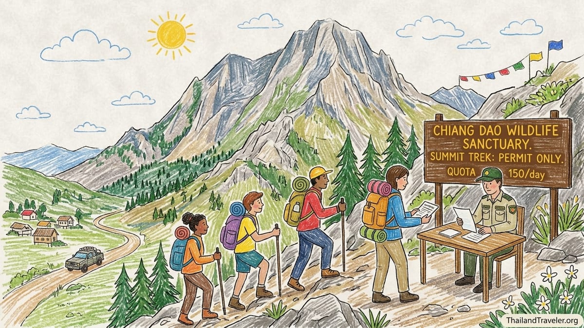
Doi Luang Chiang Dao rises to more than 2,000 meters north of Chiang Mai, inside the Chiang Dao Wildlife Sanctuary. The summit trail is tightly controlled, with access limited to a cool-season window, a daily quota of roughly 150 hikers, and a mandatory local guide registered with the sanctuary. There is no option to simply turn up at the gate and start walking. Every person on the mountain is named on a permit sheet held by rangers, and groups are checked at multiple control points along the route.
The regulations hardened after the sanctuary was recognized for its biodiversity value, including rare high-altitude plants and specialized birdlife. Rangers described the area to me as more similar to a living laboratory and seed bank than a regular national park. In practice, that means fixed routes, designated camping at Ang Salung, and strict no-go zones around sensitive ridges and sinkholes. Many older online blogs still mention day hikes to the top, but on the ground in 2026 the standard visitor option is a 2-day, 1-night trek under permit, with a structured schedule.
Before my trip, I had walked many Thai peaks that function like scenic extensions of a road: Doi Inthanon’s platforms, Doi Suthep’s forest trails, even easy pagoda climbs near Chiang Rai. Doi Luang Chiang Dao is the opposite model. It is a mountain where science, conservation, and visitor management come first, and tourism fits around those priorities. That reality shaped every step of my preparation, from the way I booked the permit to how I packed my bag.
This contrast is also why many travelers are surprised or disappointed when they reach Chiang Dao town and discover they cannot simply arrange the summit on arrival. In high season, most of the limited quota is already booked by Thai trekking clubs and domestic groups who secured their slots in October. For international visitors, the easiest route is to work through a local operator that already collaborates with the sanctuary office and understands the evolving rules.
Booking the Permit: October Window, Local Operator and Paperwork
The most important lesson from my experience is that the permit controls your entire itinerary. When I planned my trek for late December, I did not start with hotel searches or bus tickets. I started with the sanctuary quota. Each year, the booking window typically opens for several days in October on the sanctuary’s Thai-language system. Places are snapped up quickly by domestic groups, and payment is usually processed through Thai online banking. For most foreigners, this combination of language and payment barriers makes direct booking very difficult.
To navigate this, I contacted a Chiang Mai-based trekking company that specializes in Doi Luang Chiang Dao and has recent experience dealing with the wildlife sanctuary paperwork. Agencies of this type usually bundle the sanctuary permit, mandatory guide, porters, camping gear, and park transport into a single package. In my case, I paid a deposit in September, and the operator used their staff to enter my name into the permit system once the October window opened. A week later, I received confirmation of my assigned date, group size, and the official route via Ang Salung camp.
The operator requested a scanned passport page, an emergency contact, and a short health questionnaire. This was not a formality. The sanctuary requires operators to certify that participants meet basic fitness and health criteria, and some groups may be asked to provide a doctor’s note if there is a known cardiac or respiratory history. In my group, one hiker over 60 brought a letter from a Bangkok hospital confirming he was fit for demanding trekking at altitude. The rangers checked his paperwork when we signed in at the wildlife sanctuary office.
Costs for the overall package reflected this bureaucratic overhead as well as the conservation fees. For my 2-day, 1-night group trek with four participants, the per-person price from Chiang Mai was just under the equivalent of 6,000 to 7,000 Thai baht. This covered the sanctuary’s conservation fee, camping and tent charges, mandatory guide and porter wages, a simple dinner and breakfast on the mountain, and round-trip transport from Chiang Mai to the trailhead via the wildlife sanctuary office. Prices change with exchange rates and fuel costs, but prospective trekkers should expect a figure in this range rather than a cheap walk-in hike.
Medical Documentation, Briefing and Environmental Training
On the afternoon before our trek, we reported to the Chiang Dao Wildlife Sanctuary office, located a short drive from Chiang Dao town. This pre-hike appointment was part medical screening, part paperwork, and part environmental training. Rangers checked our passports against the permit list and asked each of us to confirm emergency contact phone numbers. Our guide collected a stack of forms in Thai detailing group composition, planned camp location, and expected return time.
The medical component was pragmatic rather than intrusive. Staff asked about history of heart disease, severe asthma, and serious knee issues, and they took a quick look at each participant’s footwear and clothing. There was no full physical examination, but the message was clear: if someone looked obviously unprepared, rangers had the authority to refuse access. Our guide told us this occasionally happens with visitors who turn up in sandals or fashion trainers or who underestimate the climb based on social media photos.
The most interesting part for me was the environmental training. In a small briefing room, a ranger used photographs to walk us through some of the fragile plants we might see, including high-altitude endemics that exist only on Chiang Dao’s limestone ridges. He explained why campers must keep to the Ang Salung campsite, use only the designated toilet pits, and carry out every scrap of non-biodegradable waste, including used tissue and wet wipes. The group signed a declaration acknowledging these rules and accepting potential fines if we violated them.
Our guide also described the daily limits and the logic behind them. Even with a quota of roughly 150 people per day, that human pressure is concentrated onto a narrow band of trail and a single camping zone. Without strict waste rules and periodic closures for habitat recovery, the dwarf forest and alpine meadows around the summit ridge would degrade quickly. On busy weekends, the sanctuary now sends staff to patrol the camp area at dusk to check on stove use, fire bans, and rubbish storage. Knowing this in advance changed my mindset. I stopped thinking of the trek as a personal challenge and started seeing it as a temporary privilege inside a living research site.
From Chiang Dao Valley Comforts to Sanctuary Trailhead
Many visitors first meet Doi Luang Chiang Dao from the comfort of the valley guesthouses. The Chiang Dao valley is dotted with small bungalows, homestays and boutique lodges facing the sheer limestone wall of the mountain. Here, you can soak in hot springs, visit Chiang Dao Cave, or walk easy trails to forest temples such as Wat Tham Pha Plong, all without applying for any permit beyond the usual attraction tickets. Nights are quiet, and the mountain glows pink at sunset, but your feet remain firmly on the asphalt or short forest paths.
Staying in the valley the night before the trek, I understood why many travelers choose to stop at this level. My guesthouse room had a hot shower, a soft bed, and coffee delivered to the terrace while mist wrapped around the cliffs. It felt like a complete trip on its own. The summit trek, however, belongs to a different category of experience. Once you pass the sanctuary gate on the morning of your permit, you leave behind private accommodation, restaurant menus, and flexible schedules. Inside the protected area, you move on the sanctuary’s timetable, guided by local staff.
At 7:30 in the morning, a truck from our operator collected us from the guesthouse and drove to the wildlife sanctuary office for a final check-in. After signatures and a short weather update from the rangers, we transferred to a local 4x4 truck for the rough approach road to the Den Ya Khat trailhead. Seatbelts were basic and the ride was noisy, but that short off-road journey felt like a boundary between the comfortable valley and the stricter world of the sanctuary.
At the trailhead, our porters loaded the group tent sections, cooking pots, fuel, and food. Each trekker carried a daypack of personal gear, water, and extra layers, while the porters’ woven baskets held most of the communal weight. The division of labor may feel luxurious to ultra-light hikers, but it is how the sanctuary balances visitor comfort, safety, and local employment. Porters are also crucial for ensuring that nothing is left on the mountain when groups depart.
The Climb: Distance, Elevation and On-Trail Conditions
From Den Ya Khat to the Ang Salung campsite, our guide estimated the walking distance at roughly 7 to 8 kilometers with around 1,500 meters of total ascent. GPS readings among trekkers in recent seasons suggest similar numbers, although the exact figure depends on the line you take through steeper sections and short side detours. Our group, moving at a moderate pace with frequent breaks, took a little over five hours from trailhead to camp, including lunch and photo stops.
The first section wound through mixed evergreen forest, with a generally steady gradient and shaded switchbacks. Underfoot, the trail was mostly packed earth with scattered roots and loose stones, still slick from overnight dew. Temperatures in December were cool at the start, around the mid-teens Celsius, which made the initial climb pleasantly brisk. After about two hours, the trail steepened and began to cross open limestone outcrops where the sun felt intense, even in the cool season. Here the path narrowed and demanded more attention, with sharper rocks ready to bruise any misstep.
The final hour before Ang Salung camp was the most taxing. The trail ascended in short, very steep pitches on rough limestone, with occasional fixed ropes or tree roots used as handholds. In dry conditions, this section is simply strenuous. In wet weather, it can border on hazardous, and rangers sometimes delay or stop groups if the rock is slick. Our ascent day was mostly clear, with high cloud drifting across the summit, so we could move steadily. Even with favorable conditions, this was not a route for anyone unused to extended, sweaty climbs with a loaded pack.
Our guide recommended that trekkers be comfortable with several hours of continuous uphill hiking, ideally with some prior experience on comparable mountains such as Doi Suthep’s Monk’s Trail or multi-hour jungle hikes in northern Thailand. Cardio fitness mattered more than speed. Two members of our group who regularly ran or cycled handled the gradient well, while another hiker who trained mainly on flat city walks struggled more on the steeper upper slopes and arrived at camp visibly exhausted.
Ang Salung Camp: Tents, Water, Food and Night Temperatures
Ang Salung, the designated campsite for summit treks, sits on a high saddle surrounded by ridges. It is not a developed campground in the national-park sense. There are no permanent huts or formal platforms. Instead, tents are pitched on small leveled patches among low shrubs and rocky ground. The sanctuary provides basic long-drop toilets, screened for privacy, and simple water collection points supplied by nearby springs and rain-fed storage. All other comfort comes from what is carried in by guides and porters.
Our operator supplied dome tents that slept two, slightly narrow but adequate. Each person received a foam sleeping mat and a three-season sleeping bag. In December, the night temperature at camp dropped into the single digits Celsius. Inside the tent, with a good bag and base layers, I was comfortable, but some trekkers wearing only light tropical clothing felt the chill. If you tend to feel the cold, packing thermal leggings, a beanie, and a down or synthetic insulated jacket is worth the weight, even if you rarely need such gear elsewhere in Thailand.
Water and food arrangements were straightforward but required discipline. Our porters boiled and treated water from a spring near camp, which we used to refill bottles for the summit push and descent. We had been advised to carry containers totaling at least three liters per person, and I was glad I had followed that guidance. The combination of sustained climbing, dry air, and high sun can dehydrate hikers unexpectedly. Dinner was a simple but satisfying spread of rice, vegetable stir-fry, and a mild chicken curry shared under headlamps around the cooking area. Breakfast before sunrise consisted of hot rice porridge, instant coffee, and bananas.
One of the sanctuary’s firm rules is that all non-organic waste returns to the valley. Our guide carried a dedicated rubbish sack, and we tucked snack wrappers and used tissue into small zip pouches during the day. At first this felt fussy, but standing among the clean, crisp air of Ang Salung, with only faint glows from other tents, I understood why it mattered. A single careless group could transform the high camp into a trash-strewn clearing within a weekend. Instead, it still felt close to wilderness.
Summit Push, Views and Physical Demands
We left camp at around 4:30 in the morning, following a line of headlamps as other groups started the summit push. The distance from Ang Salung to the top is short, a little over a kilometer, but the path is steep and technical in places, with rocky steps and narrow traverses. Our guide asked us to keep phones and cameras packed away until we reached safer vantage points, partly to reduce the risk of distractions on exposed sections.
The climb in the dark was slow and breathy. The air felt thinner and cooler, somewhere in the high single digits or low teens Celsius with a steady breeze along the ridge. My legs, already tired from the previous day, protested as we hauled ourselves up the final rocky steps. The ascent from camp to the summit ridge took our group about an hour and a half, including short pauses to manage footing and let lines of hikers pass. When we emerged onto the open crest just before sunrise, the early start suddenly felt worthwhile.
The views were not the cloud-sea fantasy some travelers imagine, but they were expansive and layered. To the east, light leaked over distant ridges, turning the valley mists into silver ribbons between low hills. To the north, sharper peaks of the Daen Lao Range staggered toward the Myanmar border, their silhouettes distinct against the brightening sky. Below us, limestone spires, sinkholes, and folded ridges gave a sense of how complex the karst landscape really is, far beyond the single cliff face visible from the valley lodges.
We stayed on the summit area for about 40 minutes as the full sun rose, careful to keep to the indicated zones and not trample low plants. Rangers sometimes restrict access to the very highest rocks if conditions are windy or if too many people cluster there at once. It is important not to treat the top like a playground or photo set. After a second, shorter climb back up from camp for sunset in the afternoon, I realized the trek had been more demanding than I had expected from the many triumphant, filtered photos online. The combination of bureaucracy, long ascent, rough limestone, and cold night air made it feel like a serious, if short, alpine-style outing.
Why Rules, Quotas and Fixed Routes Matter
Spending two days on the mountain made the sanctuary’s strict rules feel less like obstacles and more like common sense. Along the trail, our guide pointed out several high-altitude plant species that exist only on a handful of Thai peaks. Some clung to cracks in exposed limestone. Others formed small, dense cushions in shallow soil. A single group cutting a shortcut or seeking a private photo angle could crush decades of slow growth with one careless step. By keeping everyone on a well-defined path and limiting the number of daily visitors, the sanctuary gives these plants a chance to persist.
Wildlife, although elusive, added to this impression of fragility. During the evening at Ang Salung, we heard calls of night birds and glimpsed movement in the trees at the edge of camp. Rangers mentioned that the broader sanctuary supports rare species of deer, small carnivores, and specialized birds, though spotting them near the popular camp is uncommon. More obvious were signs of burrowing animals and small tracks crossing the path. The rules against feeding wildlife or leaving food waste uncovered are not just about tidiness. They reduce the risk of animals learning to seek campsites and human food, which can lead to conflicts and ecosystem imbalances.
The waste and fire regulations also speak directly to the fire risk in the dry season. On a windy ridge lined with scrub and grass, a single stray ember from an open campfire could trigger a burn that races upslope. For that reason, groups cook on gas stoves in designated areas and are banned from collecting firewood. It may feel less romantic than a glowing campfire, but it keeps the already stressed mountain environment from bearing another layer of damage. Over time, these controls also support a better experience for trekkers, who find a cleaner, quieter summit rather than a scarred one.
Daily quotas and seasonal closures can be frustrating when you are trying to fit the trek into a tight itinerary. Yet the alternative is visible on other popular mountains that once had open access and now suffer from eroded trails, trash problems, and displaced wildlife. On Doi Luang Chiang Dao, the sanctuary has chosen a different path: fewer visitors, better control, and a slower, more intentional form of access that asks trekkers to be partners in conservation rather than just consumers of the view.
The Takeaway
Looking back, several elements of my preparation for Doi Luang Chiang Dao proved essential. Starting with the permit, working through a reputable local operator, and accepting the October booking reality allowed everything else to fall into place. Good cardio fitness from regular hikes before the trip made the ascent enjoyable rather than punishing, and packing layers suitable for single-digit night temperatures kept the camp experience comfortable. Reliable footwear with firm soles and decent grip was non-negotiable on the sharp limestone, and carrying at least three liters of water capacity plus high-energy snacks made a clear difference in how I felt late in the day.
If I returned, I would change a few pieces of equipment. I would pack slightly lighter overall, leaving non-essential clothing in Chiang Dao, and I would bring trekking poles for the descent. The steep, stony sections coming down from Ang Salung to the forest trail were tough on knees, and several hikers in our wider group borrowed sticks from the forest edge as improvised poles. I would also bring a warmer hat and gloves, not for the valley but for the pre-dawn summit push where the wind cuts through sweaty layers.
Was the overnight climb worth its complexity? For me, yes. The combination of a serious limestone summit, controlled access, and the feeling of stepping briefly into a protected sanctuary made the journey feel special. The trek occupies a middle ground between tourist sightseeing and full expedition mountaineering, with enough logistical challenge to command respect. It is not something I would tack onto a northern Thailand holiday casually, but as a focused objective around which to build a few days in Chiang Dao, it justified the effort and cost.
For casual hikers or travelers with limited time, however, the summit is not the only nor necessarily the best way to experience Chiang Dao. The valley offers forest walks to Wat Tham Pha Plong, gentle paths through tea and coffee fields, and guided day hikes that climb to lower ridges for wide views of the big limestone wall. Hot springs, cave visits, and village homestays provide cultural and landscape immersion with far less bureaucracy and physical strain. If your main goal is relaxation with scenic backdrops, these easier experiences will likely be more rewarding than wrestling with permit windows and pre-dawn ascents.
FAQ
Q1. Do I really need a permit and guide to hike Doi Luang Chiang Dao summit?
The summit route lies inside a wildlife sanctuary with restricted access, so a permit and registered local guide are mandatory for every visitor beyond the checkpoint.
Q2. When is the trekking season for the summit hike?
In recent years, the main summit season has typically run from around November to March, but exact opening and closing dates are set by sanctuary staff each year based on weather and conservation factors.
Q3. How far in advance should I book my trek?
Permits are usually released in a short booking window in October, and popular dates can fill quickly, so contacting a local operator several months ahead is strongly recommended.
Q4. How fit do I need to be for the overnight trek?
You should be comfortable hiking uphill for several hours with a daypack, managing steep, uneven trails and sustained climbs of over 1,000 meters without serious cardiac or respiratory issues.
Q5. What kind of temperatures should I expect at camp and on the summit?
During cool-season treks, night temperatures at Ang Salung camp often drop to single digits Celsius, and pre-dawn summit conditions can feel colder with wind, so warm layers are important.
Q6. Can I arrange the trek after I arrive in Chiang Mai or Chiang Dao?
Some agencies can occasionally match you to an existing booking close to the date, but relying on last-minute arrangements is risky because daily quotas are tight and often fully allocated.
Q7. What does the total cost usually include?
Typical packages from Chiang Mai or Chiang Dao cover the sanctuary permit and entrance fees, guide and porter services, tents and basic camping gear, simple meals on the mountain, and round-trip transport to the trailhead.
Q8. Is water available on the trail, or must I carry everything?
Groups rely on natural sources near camp, treated and boiled by guides, so you do not carry all water from the valley but do need enough bottle capacity for long stretches between refills.
Q9. What happens if the weather is bad on my permit date?
Sanctuary staff and guides may alter schedules, delay the summit push, or cancel access if conditions are unsafe, and in such cases operators typically work with you on alternatives or partial refunds.
Q10. Are there easier alternatives for enjoying Chiang Dao’s scenery?
Yes, the Chiang Dao valley offers guesthouses with mountain views, visits to Chiang Dao Cave and forest temples, and shorter guided hikes to lower viewpoints that require no special permit or overnight camping.